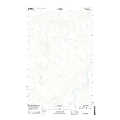
2014 Map of Mary L Pond
USGS Topo · Published 2014About this map
Mary L Pond sits at the center of this remote northern Maine landscape, where the drainage systems of the Saint John River and its tributaries define the wilderness. The survey reveals a terrain largely dominated by waterways and logging access routes, with Depot Stream and Ninemile Brook carving through the highlands. The presence of Depot Rd and B Rd indicates the vital role of timber transport and access in this undeveloped region of Aroostook County. This 2014 snapshot captures the area's geography as a critical watershed, where Burntland Brook joins the larger river system, providing a precise view of the topography before significant forest management or environmental shifts might alter these drainage patterns.
Find a feature on this map
7 named features on this map. Tap any name to fly to it.
Don’t see what you’re looking for? This feature index may not catch every label — zoom into the map to look around manually.
Map Details
Editions of this 2014 Mary L Pond Map
This is the sole edition of this map. No revisions or reprints were ever made.
Other maps of this area

1954 · Presque Isle
USGS Topo · 1:250,000

1955 · Depot Lake
USGS Topo · 1:62,500

1955 · Beaver Pond
USGS Topo · 1:62,500

1955 · Clayton Lake
USGS Topo · 1:62,500

1955 · Seven Islands
USGS Topo · 1:62,500

1958 · Presque Isle
USGS Topo · 1:250,000

1960 · Presque Isle
USGS Topo · 1:250,000

1976 · Depot Lake
USGS Topo · 1:24,000
1977 · St. Adalbert
USGS Topo · 1:24,000
1977 · Burntland Pond
USGS Topo · 1:24,000