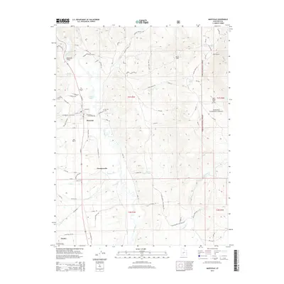
2014 Map of Marysvale
USGS Topo · Published 2014About this map
The Sevier River corridor anchors this portion of Marysvale Valley, where the community of Marysvale serves as a central hub for the surrounding ranching and mining country. Settlement patterns follow the valley floor, with Thompsonville and Alunite situated along the transport routes of S Old Highway 89 and the river. The landscape is dotted with small-scale water management features like Durkee Reservoir and Taylor Pond, essential for supporting local life in this high-elevation terrain.
Find a feature on this map
122 named features on this map. Tap any name to fly to it.
Don’t see what you’re looking for? This feature index may not catch every label — zoom into the map to look around manually.
Map Details
Editions of this 2014 Marysvale Map
This is the sole edition of this map. No revisions or reprints were ever made.
Other maps of this area

1885 · Beaver
USGS Topo · 1:250,000

1932 · Sevier
USGS Topo · 1:62,500

1935 · Sevier
USGS Topo · 1:62,500

1937 · Delano Peak
USGS Topo · 1:48,000

1940 · Monroe
USGS Topo · 1:62,500

1943 · Delano Peak
USGS Topo · 1:62,500

1944 · Monroe
USGS Topo · 1:62,500

1945 · Marysvale
USGS Topo · 1:62,500

1947 · Marysvale
USGS Topo · 1:62,500

1953 · Richfield
USGS Topo · 1:250,000