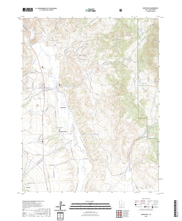
2023 Map of Marysvale
USGS Topo · Published 2023About this map
The Sevier River flows through the heart of the Marysvale Valley, shaping the settlement patterns of this Piute County region. Recent data shows the central hub of Marysvale and the smaller community of Thompsonville situated along the valley floor. The map records several legacy burial grounds, including Mountain View Cem and Thompsonville Cem, which are vital for genealogical research in this part of Utah. The infrastructure of the area is heavily influenced by mining history, evidenced by specialized road names such as VCA Mine Rd and Anderson Canyon Mine Rd. To the east, the terrain rises into the White Hills and the Fishlake National Forest, where water sources like Durkee Reservoir and Durkee Springs provide essential resources in the high-desert landscape. The western portion is dominated by the distinctive landform known as The Bench, overlooking the town below.
Find a feature on this map
62 named features on this map. Tap any name to fly to it.
Don’t see what you’re looking for? This feature index may not catch every label — zoom into the map to look around manually.
Map Details
Editions of this 2023 Marysvale Map
This is the sole edition of this map. No revisions or reprints were ever made.
Other maps of this area

1885 · Beaver
USGS Topo · 1:250,000

1932 · Sevier
USGS Topo · 1:62,500

1935 · Sevier
USGS Topo · 1:62,500

1937 · Delano Peak
USGS Topo · 1:48,000

1940 · Monroe
USGS Topo · 1:62,500

1943 · Delano Peak
USGS Topo · 1:62,500

1944 · Monroe
USGS Topo · 1:62,500

1945 · Marysvale
USGS Topo · 1:62,500

1947 · Marysvale
USGS Topo · 1:62,500

1953 · Richfield
USGS Topo · 1:250,000