
1994 Map of Maskell
USGS Topo · Published 1995About this map
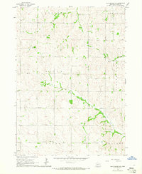
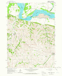
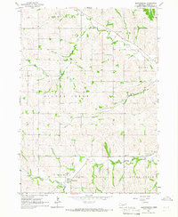
The Missouri River forms the central character of this 1994 topographic study, serving as the boundary between Dixon County, Nebraska, and Clay County, South Dakota. The landscape transitions from the broad river bottomlands to the eroded bluffs of the Fairview region. On the Nebraska side, the village of Maskell and the community of Newcastle anchor the upland terrain, surrounded by a network of drainage systems including Turkey Creek, Ames Creek, and Deer Creek.
Find a feature on this map
23 named features on this map. Tap any name to fly to it.
Don’t see what you’re looking for? This feature index may not catch every label — zoom into the map to look around manually.
Map Details
Editions of this 1994 Maskell Map
This is the sole edition of this map. No revisions or reprints were ever made.
Other maps of this area

1898 · Elk Point
USGS Topo · 1:125,000

1901 · Elk Point
USGS Topo · 1:125,000

1907 · Elk Point
USGS Topo · 1:125,000

1955 · Sioux City
USGS Topo · 1:250,000

1958 · Sioux City
USGS Topo · 1:250,000

1959 · Sioux City
USGS Topo · 1:250,000
1964 · Martinsburg SW
USGS Topo · 1:24,000

1964 · Burbank
USGS Topo · 1:24,000
1964 · Maskell
USGS Topo · 1:24,000
1964 · Martinsburg
USGS Topo · 1:24,000
Featured Places
- Newcastle, Newcastle Township
- Maskell, Hooker Township
- Newcastle Township, NE
- Vermillion Township, SD
- Fairview Township, SD