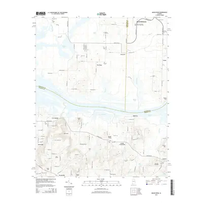
2014 Map of Mason Ridge
USGS Topo · Published 2014About this map
Wheeler Lake and the wide course of the Tennessee River dominate this modern topographical study, defining the county boundaries between Madison, Limestone, and Morgan. The landscape is characterized by its complex hydrology, featuring numerous backwaters and tributaries such as Leemon Slough, Blackwell Run, and Limestone Creek. In the northern section, the Huntsville International Airport-Carl T Jones Field stands as a massive modern infrastructure footprint, contrasting with the smaller, older settlements scattered to the south and west.
Find a feature on this map
117 named features on this map. Tap any name to fly to it.
Don’t see what you’re looking for? This feature index may not catch every label — zoom into the map to look around manually.
Map Details
Editions of this 2014 Mason Ridge Map
This is the sole edition of this map. No revisions or reprints were ever made.
Other maps of this area

1888 · Cullman
USGS Topo · 1:125,000

1888 · Huntsville
USGS Topo · 1:125,000

1892 · Cullman
USGS Topo · 1:125,000

1892 · Huntsville
USGS Topo · 1:125,000

1936 · Triana
USGS Topo · 1:24,000

1936 · Madison
USGS Topo · 1:24,000

1936 · Hartselle
USGS Topo · 1:24,000

1936 · Decatur
USGS Topo · 1:24,000

1936 · Somerville
USGS Topo · 1:24,000

1936 · Center Grove
USGS Topo · 1:24,000