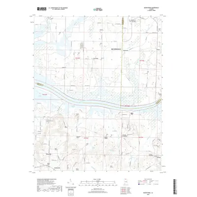
2018 Map of Mason Ridge
USGS Topo · Published 2018About this map
Huntsville International Airport-Carl T Jones Field anchors the northern portion of this landscape, reflecting the modern industrial and transportation character of the region. This 2018 survey reveals the intersection of three counties—Madison, Morgan, and Limestone—marked by the wide expanse of Wheeler Lake and the complex Rockhouse Buckeye Blackwell Dewatering Area. The terrain transitions from the low wetlands of Leemon Slough and Blackwell Swamp to the high ground of Sand Mtn High Ridge and Turkey Mtn in the south.
Find a feature on this map
134 named features on this map. Tap any name to fly to it.
Don’t see what you’re looking for? This feature index may not catch every label — zoom into the map to look around manually.
Map Details
Editions of this 2018 Mason Ridge Map
This is the sole edition of this map. No revisions or reprints were ever made.
Other maps of this area

1888 · Cullman
USGS Topo · 1:125,000

1888 · Huntsville
USGS Topo · 1:125,000

1892 · Cullman
USGS Topo · 1:125,000

1892 · Huntsville
USGS Topo · 1:125,000

1936 · Triana
USGS Topo · 1:24,000

1936 · Madison
USGS Topo · 1:24,000

1936 · Hartselle
USGS Topo · 1:24,000

1936 · Decatur
USGS Topo · 1:24,000

1936 · Somerville
USGS Topo · 1:24,000

1936 · Center Grove
USGS Topo · 1:24,000