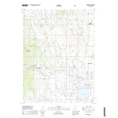
2019 Map of Masonville
USGS Topo · Published 2019About this map
Masonville and the surrounding Larimer County foothills are defined by a complex network of agricultural irrigation and family legacies. The landscape is heavily marked by the water engineering required for mountain-edge ranching, including the Handy Ditch, Louden Ditch, and Home Supply Ditch, which feed into the George Rist Reservoir and Mariano Reservoir. Genealogy researchers will find significant value in the numerous small burial sites scattered across the terrain, from the Masonville Cem and Carter Family Cem to the Boothroyd Hutchinson Cem near the Big Thompson River. The eastern edge shows the residential expansion of Loveland and Fort Collins pressing against distinctive geological formations like the Devils Backbone and the Pillar of Hercules. Notable landmarks such as Sprague Airport and the Dille Tunnel further illustrate the area's mix of private infrastructure and public utility.
Find a feature on this map
147 named features on this map. Tap any name to fly to it.
Don’t see what you’re looking for? This feature index may not catch every label — zoom into the map to look around manually.
Map Details
Editions of this 2019 Masonville Map
This is the sole edition of this map. No revisions or reprints were ever made.
Other maps of this area

1905 · Mount Olympus
USGS Topo · 1:62,500

1906 · Loveland
USGS Topo · 1:62,500

1906 · Fort Collins
USGS Topo · 1:62,500

1907 · Mount Olympus
USGS Topo · 1:62,500

1907 · Livermore
USGS Topo · 1:125,000

1908 · Loveland
USGS Topo · 1:62,500

1908 · Fort Collins
USGS Topo · 1:62,500

1909 · Livermore
USGS Topo · 1:125,000

1954 · Greeley
USGS Topo · 1:250,000

1957 · Greeley
USGS Topo · 1:250,000