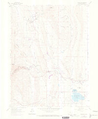
1961 Map of Masonville
USGS Topo · Published 1973About this map
The settlement of Masonville serves as the focal point of this Larimer County landscape, situated near the confluence of Buckhorn Creek and Redstone Creek. This area, mapped in the early 1960s with revisions from 1971, showcases a complex water management system essential to the region's agricultural and municipal needs. The Charles Hansen Feeder Canal and multiple aqueducts wind through the foothills, feeding into reservoirs like Boedecker Lake and Buckingham Lake.
Find a feature on this map
43 named features on this map. Tap any name to fly to it.
Don’t see what you’re looking for? This feature index may not catch every label — zoom into the map to look around manually.
Map Details
Editions of this 1961 Masonville Map
This is the sole edition of this map. No revisions or reprints were ever made.
Other maps of this area

1905 · Mount Olympus
USGS Topo · 1:62,500

1906 · Loveland
USGS Topo · 1:62,500

1906 · Fort Collins
USGS Topo · 1:62,500

1907 · Mount Olympus
USGS Topo · 1:62,500

1907 · Livermore
USGS Topo · 1:125,000

1908 · Loveland
USGS Topo · 1:62,500

1908 · Fort Collins
USGS Topo · 1:62,500

1909 · Livermore
USGS Topo · 1:125,000

1954 · Greeley
USGS Topo · 1:250,000

1957 · Greeley
USGS Topo · 1:250,000