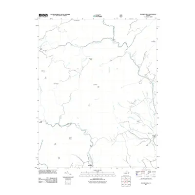
2011 Map of Massies Mill
USGS Topo · Published 2011About this map
The Tye River and its multiple forks dominate this Nelson County landscape, where the settlements of Tyro and Massies Mill sit at the crossroads of early valley travel. The terrain is defined by dramatic peaks and ridges, including The Priest, Little Priest, and The Friar, which overlook a network of creek bottoms that once supported small-scale industry. Evidence of this historical economy is visible at Perkins Mill along the Piney River and the various hollows like Cash Hollow and Little Hollow that provided shelter and passage through the mountains. For genealogists, the map preserves the locations of Bethel Cemetery, Oak Hill Cemetery, and Sandy Ridge Cemetery, alongside family-named landmarks like Coghill Ridge and Jacks Hill. This portion of Virginia retains its character through isolated mountain gaps such as Emblys Gap, connecting the highland slopes to the fertile river basins below.
Find a feature on this map
58 named features on this map. Tap any name to fly to it.
Don’t see what you’re looking for? This feature index may not catch every label — zoom into the map to look around manually.
Map Details
Editions of this 2011 Massies Mill Map
This is the sole edition of this map. No revisions or reprints were ever made.
Other maps of this area

1892 · Buckingham
USGS Topo · 1:125,000

1894 · Lexington
USGS Topo · 1:125,000

1935 · Amherst
USGS Topo · 1:48,000

1936 · Vesuvius
USGS Topo · 1:48,000

1939 · Amherst
USGS Topo · 1:62,500

1941 · Vesuvius
USGS Topo · 1:62,500

1943 · Lovingston
USGS Topo · 1:62,500

1946 · Lovingston
USGS Topo · 1:62,500

1947 · Roanoke
USGS Topo · 1:250,000

1950 · Amherst
USGS Topo · 1:62,500