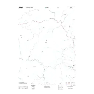
2013 Map of Massies Mill
USGS Topo · Published 2013About this map
Massies Mill and the surrounding Nelson County uplands are defined by the dramatic descent of the Tye River and its numerous mountain tributaries. The landscape is dominated by significant summits such as The Priest, The Friar, and Fork Mountain, with the Priest Trail Shelter and Harpers Creek Shelter marking the passage of high-elevation trails. This 2013 survey illustrates a rural Virginia geography where small settlements like Alhambra, Tyro, and Nash are linked by winding mountain roads like Pharsalia Rd and State Rte 827. A notable point of interest is Crabtree Falls, situated near Pinnacle Ridge, where Crabtree Creek drops through the Blue Ridge terrain. The map captures the persistent nature of these mountain communities and the complex hydrology of the North Fork Tye River and South Fork Tye River as they converge and flow toward the Piedmont.
Find a feature on this map
65 named features on this map. Tap any name to fly to it.
Don’t see what you’re looking for? This feature index may not catch every label — zoom into the map to look around manually.
Map Details
Editions of this 2013 Massies Mill Map
This is the sole edition of this map. No revisions or reprints were ever made.
Other maps of this area

1892 · Buckingham
USGS Topo · 1:125,000

1894 · Lexington
USGS Topo · 1:125,000

1935 · Amherst
USGS Topo · 1:48,000

1936 · Vesuvius
USGS Topo · 1:48,000

1939 · Amherst
USGS Topo · 1:62,500

1941 · Vesuvius
USGS Topo · 1:62,500

1943 · Lovingston
USGS Topo · 1:62,500

1946 · Lovingston
USGS Topo · 1:62,500

1947 · Roanoke
USGS Topo · 1:250,000

1950 · Amherst
USGS Topo · 1:62,500