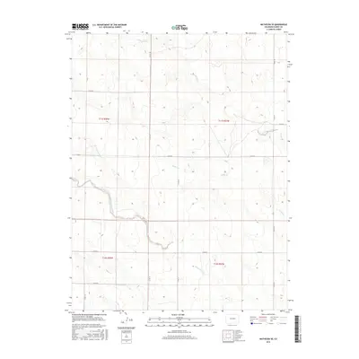
2016 Map of Matheson SE
USGS Topo · Published 2016About this map
The High Plains of eastern Elbert County are defined by the intermittent drainages of the Rush Creek system, flowing through a landscape structured by the Public Land Survey System. The area is dominated by the seasonal courses of North Rush Creek and Apache Cr, which carve shallow depressions across the terrain. A sparse network of county roads, including Co RD 181 and Co RD 197, follows the rigid section lines of the survey grid, highlighting the region's agricultural and ranching organization. This mid-2010s survey reveals the persistent rural character of the land, where the only significant topographic interruptions are the winding paths of Middle Rush Creek and its various tributaries. The map serves as a record of the precise land divisions and the hydrological patterns that have dictated settlement and land use in this part of Colorado for generations.
Find a feature on this map
19 named features on this map. Tap any name to fly to it.
Don’t see what you’re looking for? This feature index may not catch every label — zoom into the map to look around manually.
Map Details
Editions of this 2016 Matheson SE Map
This is the sole edition of this map. No revisions or reprints were ever made.
Other maps of this area

1889 · Sanborn
USGS Topo · 1:125,000

1891 · Sanborn
USGS Topo · 1:125,000

1891 · Limon
USGS Topo · 1:125,000

1892 · Limon
USGS Topo · 1:125,000

1893 · Sanborn
USGS Topo · 1:125,000

1954 · Limon
USGS Topo · 1:250,000

1954 · Lamar
USGS Topo · 1:250,000

1957 · Limon
USGS Topo · 1:250,000

1958 · Limon
USGS Topo · 1:250,000

1958 · Lamar
USGS Topo · 1:250,000