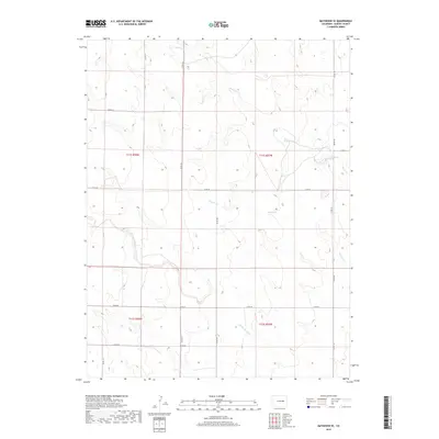
2019 Map of Matheson SE
USGS Topo · Published 2019About this map
North Rush Creek and Middle Rush Creek carve subtle drainage patterns across this Elbert County landscape, illustrating the essential relationship between water and survival in the high plains. The terrain is organized by a strict section-line road grid, including Co Rd 181 and Co Rd 197, which dictates the movement of people and livestock through these vast ranching reaches. Occasional smaller waterways like Apache Cr feed into the larger creek systems, while the presence of Co Rd 58 and Co Rd 46 connects these remote parcels to the wider county network. This 2019 survey documents a landscape of large-scale land management, where the physical geography of the Rush Creek tributaries remains the dominant natural feature amidst the human-imposed geometry of township and range boundaries.
Find a feature on this map
19 named features on this map. Tap any name to fly to it.
Don’t see what you’re looking for? This feature index may not catch every label — zoom into the map to look around manually.
Map Details
Editions of this 2019 Matheson SE Map
This is the sole edition of this map. No revisions or reprints were ever made.
Other maps of this area

1889 · Sanborn
USGS Topo · 1:125,000

1891 · Sanborn
USGS Topo · 1:125,000

1891 · Limon
USGS Topo · 1:125,000

1892 · Limon
USGS Topo · 1:125,000

1893 · Sanborn
USGS Topo · 1:125,000

1954 · Limon
USGS Topo · 1:250,000

1954 · Lamar
USGS Topo · 1:250,000

1957 · Limon
USGS Topo · 1:250,000

1958 · Limon
USGS Topo · 1:250,000

1958 · Lamar
USGS Topo · 1:250,000