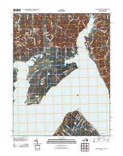
2011 Map of Mathias Point
USGS Topo · Published 2011About this map
Blossom Point Proving Grounds and the Harry Diamond Laboratories occupy the strategic peninsula where the Potomac River bends sharply at Upper Cedar Point. This 2011 survey reveals a landscape defined by its riverine geography, featuring a series of named points and necks such as Mathias Point Neck and Cedar Point Neck that reach into the broad tidal waters. The maritime and aviation character of the region is evident through the presence of Goose Bay Marina and the Lanseair Farms Airport.
Find a feature on this map
94 named features on this map. Tap any name to fly to it.
Don’t see what you’re looking for? This feature index may not catch every label — zoom into the map to look around manually.
Map Details
Editions of this 2011 Mathias Point Map
This is the sole edition of this map. No revisions or reprints were ever made.
Other maps of this area

1889 · Fredericksburg
USGS Topo · 1:125,000

1890 · Mt. Vernon
USGS Topo · 1:125,000

1891 · Mt. Vernon
USGS Topo · 1:125,000

1892 · Fredericksburg
USGS Topo · 1:125,000

1892 · Brandywine
USGS Topo · 1:62,500

1894 · Wicomico
USGS Topo · 1:62,500

1894 · Fredericksburg
USGS Topo · 1:125,000

1894 · Mt. Vernon
USGS Topo · 1:125,000

1895 · Wicomico
USGS Topo · 1:62,500

1895 · Brandywine
USGS Topo · 1:62,500