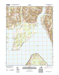
2013 Map of Mathias Point
USGS Topo · Published 2013About this map
The Potomac River dominates this landscape where the Port Tobacco River meets the wider waterway between Maryland and Virginia. This 2013 survey illustrates a region characterized by small residential enclaves and significant government installations. The Blossom Point Proving Grounds and Harry Diamond Laboratories occupy the expansive Cedar Point Neck, a peninsula bounded by Gumtree Cove and the main river channel. These facilities stand in contrast to the nearby clusters of Welcome Acres, Melody Acres, and Sutton Acres. Nautical access is a defining feature of local life, evidenced by the Port Tobacco Marina and Goose Bay Marina. Across the water, Mathias Point Neck in Virginia marks a sharp bend in the Potomac, highlighting the area's role as a maritime corridor. Further inland, the map captures private aviation at Lanseair Farms Airport and historic landings like Simms Landing.
Find a feature on this map
89 named features on this map. Tap any name to fly to it.
Don’t see what you’re looking for? This feature index may not catch every label — zoom into the map to look around manually.
Map Details
Editions of this 2013 Mathias Point Map
This is the sole edition of this map. No revisions or reprints were ever made.
Other maps of this area

1889 · Fredericksburg
USGS Topo · 1:125,000

1890 · Mt. Vernon
USGS Topo · 1:125,000

1891 · Mt. Vernon
USGS Topo · 1:125,000

1892 · Fredericksburg
USGS Topo · 1:125,000

1892 · Brandywine
USGS Topo · 1:62,500

1894 · Wicomico
USGS Topo · 1:62,500

1894 · Fredericksburg
USGS Topo · 1:125,000

1894 · Mt. Vernon
USGS Topo · 1:125,000

1895 · Wicomico
USGS Topo · 1:62,500

1895 · Brandywine
USGS Topo · 1:62,500