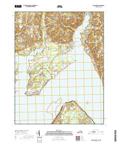
2019 Map of Mathias Point
USGS Topo · Published 2019About this map
The Potomac River dominates this coastal landscape, where the Maryland and Virginia state lines meet at Mathias Point. Along the northern shore in Charles County, the Port Tobacco River carves a deep path inland, separating the residential developments of Potomac Shores and Sutton Acres from the agrarian and forested reaches of Brentland. This area is characterized by its numerous geographic points and necks, such as Cedar Point Neck and Tayloe Neck, which stretch into the waterway. Historical and community anchors are visible in the form of the Zion Baptist Church Cem near Hill Top and the Saint Ignatius Cem overlooking the river. The presence of the Potomac Heritage National Scenic Trail and the Lanseair Farms Airport suggests a modern landscape that balances recreational access with rural transport infrastructure.
Find a feature on this map
102 named features on this map. Tap any name to fly to it.
Don’t see what you’re looking for? This feature index may not catch every label — zoom into the map to look around manually.
Map Details
Editions of this 2019 Mathias Point Map
This is the sole edition of this map. No revisions or reprints were ever made.
Other maps of this area

1889 · Fredericksburg
USGS Topo · 1:125,000

1890 · Mt. Vernon
USGS Topo · 1:125,000

1891 · Mt. Vernon
USGS Topo · 1:125,000

1892 · Fredericksburg
USGS Topo · 1:125,000

1892 · Brandywine
USGS Topo · 1:62,500

1894 · Wicomico
USGS Topo · 1:62,500

1894 · Fredericksburg
USGS Topo · 1:125,000

1894 · Mt. Vernon
USGS Topo · 1:125,000

1895 · Wicomico
USGS Topo · 1:62,500

1895 · Brandywine
USGS Topo · 1:62,500