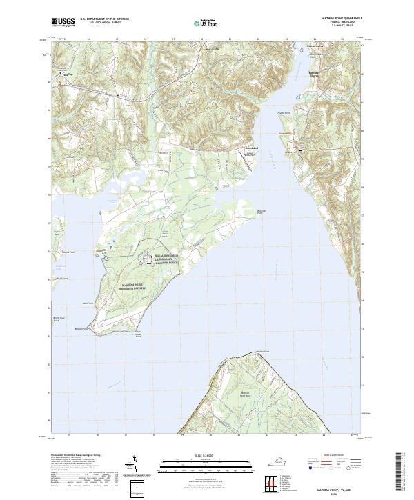
2022 Map of Mathias Point
USGS Topo · Published 2022About this map
The confluence of the Potomac River and the Port Tobacco River defines this coastal landscape where the Maryland-Virginia state line threads through the open water. This 2022 survey captures the distinct peninsula geography of Mathias Point Neck and Cedar Point Neck, where the marshy edges of Gumtree Cove and Bluff Point Cove meet the wooded uplands of King George County. The map documents established communities such as Brentland and Potomac Shores, alongside a network of family-named landmarks like Benny Gray Point and Balls Point. Local heritage is anchored by sites like the Zion Baptist Church Cem near Hill Top and the Saint Ignatius Cem at Chapel Point, while the Potomac Heritage National Scenic Trail winds through the northern reach near McConchie.
Find a feature on this map
108 named features on this map. Tap any name to fly to it.
Don’t see what you’re looking for? This feature index may not catch every label — zoom into the map to look around manually.
Map Details
Editions of this 2022 Mathias Point Map
This is the sole edition of this map. No revisions or reprints were ever made.
Other maps of this area

1889 · Fredericksburg
USGS Topo · 1:125,000

1890 · Mt. Vernon
USGS Topo · 1:125,000

1891 · Mt. Vernon
USGS Topo · 1:125,000

1892 · Fredericksburg
USGS Topo · 1:125,000

1892 · Brandywine
USGS Topo · 1:62,500

1894 · Wicomico
USGS Topo · 1:62,500

1894 · Fredericksburg
USGS Topo · 1:125,000

1894 · Mt. Vernon
USGS Topo · 1:125,000

1895 · Wicomico
USGS Topo · 1:62,500

1895 · Brandywine
USGS Topo · 1:62,500