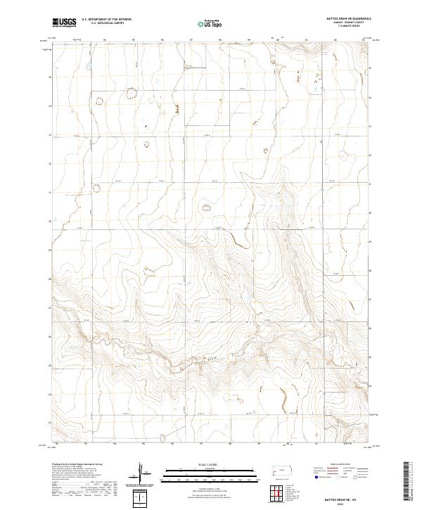
2022 Map of Mattox Draw NE
USGS Topo · Published 2022About this map
James Draw winds through this expanse of Kearny County, carving a distinct hydrological path across a landscape defined by the Public Land Survey System. The map highlights the intersection of several townships, including t21s r37w, t21s r36w, t22s r37w, and t22s r36w, illustrating the geometric precision of western land division. A network of rural section-line roads, such as Co Rd K, Co RD 3, and Rd 330, provides the primary infrastructure for the area's agricultural operations. The terrain is marked by subtle elevation changes and numerous small depressions, typical of the High Plains environment, where the drainage of James Draw serves as a central geographical landmark for local land management and navigation.
Find a feature on this map
54 named features on this map. Tap any name to fly to it.
Don’t see what you’re looking for? This feature index may not catch every label — zoom into the map to look around manually.
Map Details
Editions of this 2022 Mattox Draw NE Map
This is the sole edition of this map. No revisions or reprints were ever made.
Other maps of this area

1941 · Modoc
USGS Topo · 1:62,500

1951 · Modoc
USGS Topo · 1:62,500

1955 · Scott City
USGS Topo · 1:250,000

1958 · Scott City
USGS Topo · 1:250,000

1965 · Leoti 3 NW
USGS Topo · 1:24,000

1965 · Leoti 3 NE
USGS Topo · 1:24,000

1965 · Wolf NW
USGS Topo · 1:24,000
1966 · Leoti 3 SW
USGS Topo · 1:24,000
1966 · Wolf SW
USGS Topo · 1:24,000
1966 · Leoti 3 SE
USGS Topo · 1:24,000