
1965 Map of Leoti 3 NE
USGS Topo · Published 1967About this map
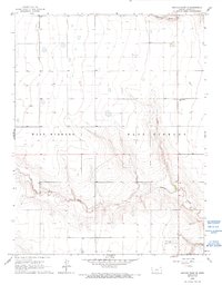
Campbell Draw and James Draw carve distinct drainage patterns through this section of the High Plains, providing a topographic relief that stands in contrast to the surrounding tableland. Located in Kearny County, the area reflects a mid-century rural landscape defined by large landholdings and early energy exploration. The presence of a Gas Well and another Well near the southern boundary points to the developmental focus of the era, while the Dienst Ranch and a small Airport nearby suggest a settled but open ranching environment.
Find a feature on this map
11 named features on this map. Tap any name to fly to it.
Don’t see what you’re looking for? This feature index may not catch every label — zoom into the map to look around manually.
Map Details
Editions of this 1965 Leoti 3 NE Map
2 editions found
Other maps of this area

1941 · Modoc
USGS Topo · 1:62,500

1951 · Modoc
USGS Topo · 1:62,500

1955 · Scott City
USGS Topo · 1:250,000

1958 · Scott City
USGS Topo · 1:250,000

1965 · Leoti 3 NW
USGS Topo · 1:24,000

1965 · Wolf NW
USGS Topo · 1:24,000
1966 · Leoti 3 SW
USGS Topo · 1:24,000
1966 · Wolf SW
USGS Topo · 1:24,000
1966 · Leoti 3 SE
USGS Topo · 1:24,000

1970 · Lydia
USGS Topo · 1:24,000