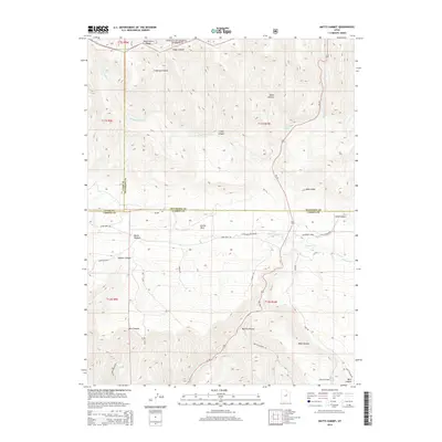
2014 Map of Matts Summit
USGS Topo · Published 2014About this map
Ashley National Forest dominates the northern landscape of this high-elevation region where Utah, Duchesne, and Carbon Counties meet. The rugged topography is defined by significant landmarks such as Reservation Ridge and the Roan Cliffs, which separate drainage systems like Logge Canyon from the more developed lands to the south. In the central flats, the settlement area of Emma Park sits near the headwaters of Willow Creek, serving as a focal point for the mountain road network that includes Emma Park Rd and Jack Canyon Rd.
Find a feature on this map
43 named features on this map. Tap any name to fly to it.
Don’t see what you’re looking for? This feature index may not catch every label — zoom into the map to look around manually.
Map Details
Editions of this 2014 Matts Summit Map
This is the sole edition of this map. No revisions or reprints were ever made.
Other maps of this area

1886 · Price River
USGS Topo · 1:250,000

1896 · Price River
USGS Topo · 1:250,000

1914 · Castle Gate
USGS Topo · 1:62,500

1915 · Wellington
USGS Topo · 1:62,500

1916 · Castle Gate
USGS Topo · 1:62,500

1956 · Price
USGS Topo · 1:250,000

1960 · Price
USGS Topo · 1:250,000

1962 · Price
USGS Topo · 1:250,000
1968 · Jones Hollow
USGS Topo · 1:24,000
1969 · Flat Ridge
USGS Topo · 1:24,000