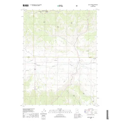
2020 Map of Matts Summit
USGS Topo · Published 2020About this map
Ashley National Forest dominates the northern reaches of this high-elevation landscape, where Reservation Ridge marks a clear boundary between the forest and the broken terrain of the Roan Cliffs. This 2020 topographic record highlights the complex geography of the Emma Park area, a wide valley corridor intersected by a network of drainage systems and isolated springs like Box Spring and Ripe Spring. The map documents the convergence of several county lines, including the borders of Utah, Duchesne, and Carbon counties, which meet in this area of intricate canyons and high passes.
Find a feature on this map
33 named features on this map. Tap any name to fly to it.
Don’t see what you’re looking for? This feature index may not catch every label — zoom into the map to look around manually.
Map Details
Editions of this 2020 Matts Summit Map
This is the sole edition of this map. No revisions or reprints were ever made.
Other maps of this area

1886 · Price River
USGS Topo · 1:250,000

1896 · Price River
USGS Topo · 1:250,000

1914 · Castle Gate
USGS Topo · 1:62,500

1915 · Wellington
USGS Topo · 1:62,500

1916 · Castle Gate
USGS Topo · 1:62,500

1956 · Price
USGS Topo · 1:250,000

1960 · Price
USGS Topo · 1:250,000

1962 · Price
USGS Topo · 1:250,000
1968 · Jones Hollow
USGS Topo · 1:24,000
1969 · Flat Ridge
USGS Topo · 1:24,000