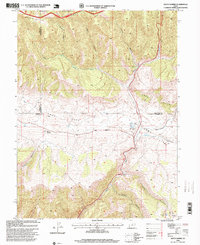
1996 Map of Matts Summit
USGS Topo · Published 1999About this map
Ashley National Forest and the high ridges of the Roan Cliffs dominate this 1990s topographic study of the Carbon and Duchesne county border. The landscape is defined by its dramatic verticality, where Meridian Ridge separates the northern canyons from the high-altitude basin of Emma Park. Hydrological features include the West Fork Willow Creek and smaller water sources like Box Spring and Pipe Spring, which were vital for life in this arid, high-elevation environment. Resource extraction and management are visible through the inclusion of a Gravel Pit and a Gaging Station along the creek. The area near Matts Summit serves as a critical geographic marker where multiple county lines converge amidst a network of deep drainages such as Mathis Canyon and Buck Canyon.
Find a feature on this map
25 named features on this map. Tap any name to fly to it.
Don’t see what you’re looking for? This feature index may not catch every label — zoom into the map to look around manually.
Map Details
Editions of this 1996 Matts Summit Map
This is the sole edition of this map. No revisions or reprints were ever made.
Other maps of this area

1886 · Price River
USGS Topo · 1:250,000

1896 · Price River
USGS Topo · 1:250,000

1914 · Castle Gate
USGS Topo · 1:62,500

1915 · Wellington
USGS Topo · 1:62,500

1916 · Castle Gate
USGS Topo · 1:62,500

1956 · Price
USGS Topo · 1:250,000

1960 · Price
USGS Topo · 1:250,000

1962 · Price
USGS Topo · 1:250,000
1968 · Jones Hollow
USGS Topo · 1:24,000
1969 · Flat Ridge
USGS Topo · 1:24,000