2022 Map of Maud
USGS Topo · Published 2022About this map
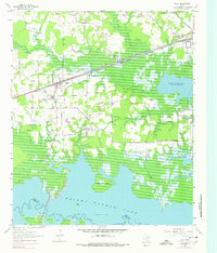
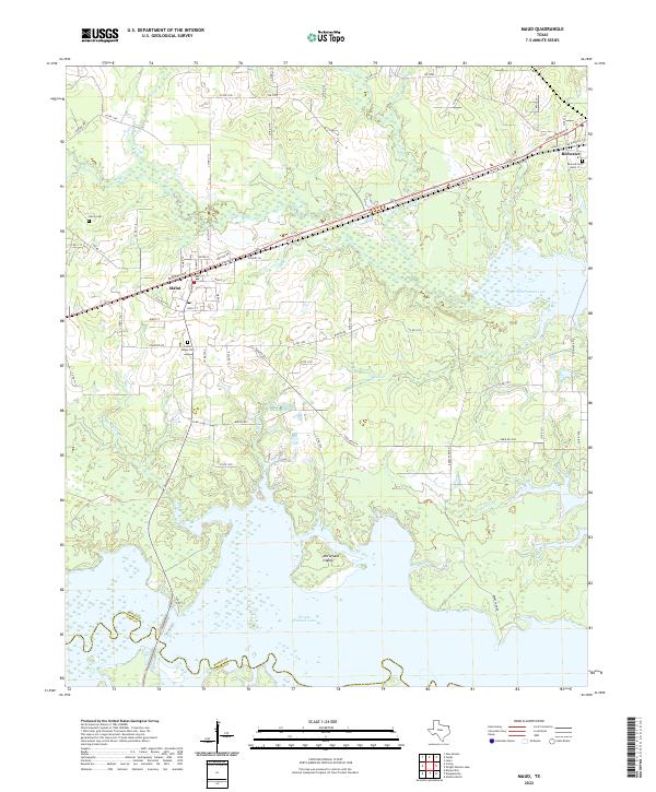
Wright Patman Lake dominates the southern landscape of this Bowie County survey, defining the modern shoreline and isolating McFarland Island. The settlement of Maud serves as a central hub, where local streets like Austin St and Lamar St intersect near the Po. To the northeast, the community of Redwater sits along the rail corridor, anchored by the Atwood Cem. The geography is heavily influenced by a network of drainage systems, including Big Creek and Milan Creek, which feed into the primary reservoir. For those tracing family histories in the region, the map documents several established burial grounds including Harris Cem and Center Ridge Cem, situated among a dense network of county roads and local routes like FM 2149 and FM 991.
Find a feature on this map
74 named features on this map. Tap any name to fly to it.
Don’t see what you’re looking for? This feature index may not catch every label — zoom into the map to look around manually.
Map Details
Editions of this 2022 Maud Map
This is the sole edition of this map. No revisions or reprints were ever made.