
1954 Map of Maui
USGS Topo · Published 1954About this map
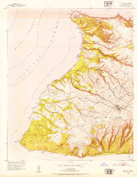
Haleakala National Park dominates the eastern half of this mid-century survey, a landscape defined by volcanic terrain and extensive forest reserves like the Koolau Forest Reserve. The island's development is concentrated in the central valley and along the western coast, where the historic port of Lahaina and the industrial hub of Kahului serve as primary anchors. The presence of numerous specialized settlements, including Honokohau Camp, Pukalani Camp, and Haliimaile Camp, points to the era's agricultural and plantation-based economy.
Find a feature on this map
110 named features on this map. Tap any name to fly to it.
Don’t see what you’re looking for? This feature index may not catch every label — zoom into the map to look around manually.
Map Details
Editions of this 1954 Maui Map
This is the sole edition of this map. No revisions or reprints were ever made.
Other maps of this area

1923 · Island of Lanai
USGS Topo · 1:31,680

1925 · Island of Lanai
USGS Topo · 1:62,500

1929 · Kahoolawe
USGS Topo · 1:62,500

1952 · Halawa
USGS Topo · 1:24,000

1952 · Molokai Airport
USGS Topo · 1:24,000

1952 · Kamalo
USGS Topo · 1:24,000
1952 · Ilio Point
USGS Topo · 1:24,000

1952 · Kaunakakai
USGS Topo · 1:24,000

1954 · Oahu
USGS Topo · 1:250,000

1954 · Hawaii North
USGS Topo · 1:250,000