
1966 Map of Maui
USGS Topo · Published 1966About this map
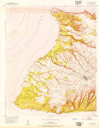
Maui, Molokai, Lanai, and Kahoolawe form the central Hawaiian group as it stood in the mid-1960s, a landscape defined by its agricultural foundations and early tourism development. The volcanic peaks of Mauna Loa and the massive Haliakala National Park dominate the terrain, while the lowlands are marked by plantations and established island hubs like Wailuku and Kahului. Settlement patterns reflect the islands' self-contained economies, from the pineapple-centered Lanai City and its port at Kaumalapau to the leeward cattle country and the burgeoning resort area at Kaanapali. Marine navigation remains vital to these connected islands, as seen in the multiple channel crossings and the Molokai Lighthouse at Kahiu Point. The map also captures several conservation areas, including the Molokai Forest Reserve and West Maui Forest Reserve, protecting the vital watersheds of the Honokohau Stream and Iao Stream.
Find a feature on this map
93 named features on this map. Tap any name to fly to it.
Don’t see what you’re looking for? This feature index may not catch every label — zoom into the map to look around manually.
Map Details
Editions of this 1966 Maui Map
This is the sole edition of this map. No revisions or reprints were ever made.
Other maps of this area

1923 · Island of Lanai
USGS Topo · 1:31,680

1925 · Island of Lanai
USGS Topo · 1:62,500

1929 · Kahoolawe
USGS Topo · 1:62,500

1952 · Halawa
USGS Topo · 1:24,000

1952 · Molokai Airport
USGS Topo · 1:24,000

1952 · Kamalo
USGS Topo · 1:24,000
1952 · Ilio Point
USGS Topo · 1:24,000

1952 · Kaunakakai
USGS Topo · 1:24,000

1954 · Oahu
USGS Topo · 1:250,000

1954 · Maui
USGS Topo · 1:250,000