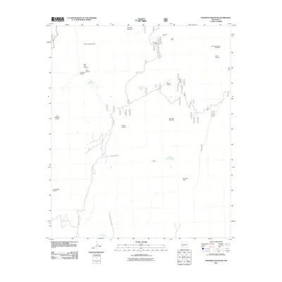
2011 Map of Maverick Mountain
USGS Topo · Published 2011About this map
Royal John Mine and several neighboring prospects including the Columbia Mine and Grandview Mine define the industrial history of this high-elevation landscape. The topography is dominated by prominent summits such as Maverick Mountain, Noonday Peak, and Seven Brothers Mountain, which overlook a network of canyons including Silver Creek Canyon and Little Gallinas Canyon. This 2011 survey captures the area's essential water management features, including the LC Dam and various stock tanks like Corral Canyon Tank and Upton Tank. Access to these remote sites is traced via the winding Royal John Mine Rd, while the southern reaches of the map include Mimbres Cold Springs, indicating the critical locations of water sources in this arid environment.
Find a feature on this map
27 named features on this map. Tap any name to fly to it.
Don’t see what you’re looking for? This feature index may not catch every label — zoom into the map to look around manually.
Map Details
Editions of this 2011 Maverick Mountain Map
This is the sole edition of this map. No revisions or reprints were ever made.
Other maps of this area

1935 · Hillsboro
USGS Topo · 1:48,000

1940 · Hillsboro
USGS Topo · 1:62,500

1955 · Las Cruces
USGS Topo · 1:250,000

1956 · Dwyer
USGS Topo · 1:62,500

1956 · San Lorenzo
USGS Topo · 1:62,500

1958 · Las Cruces
USGS Topo · 1:250,000

1962 · Lake Valley
USGS Topo · 1:62,500

1982 · Hatch
USGS Topo · 1:100,000
1985 · Dwyer
USGS Topo · 1:24,000
1985 · P A Mountain
USGS Topo · 1:24,000