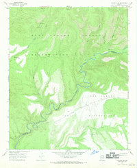
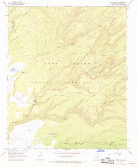
1967 Map of Maverick SW
USGS Topo · Published 1970About this map
The Black River serves as the primary geographic and political boundary in this 1960s Arizona landscape, dividing the Fort Apache Indian Reservation to the north from the San Carlos Indian Reservation to the south. This rugged canyon country is defined by deep drainage systems like Paddy Creek and Sharp Creek that feed into the main river channel. At higher elevations, the Lookout Tower atop Maverick Mtn overlooks the complex terrain of the Apache Co Graham Co line.
Find a feature on this map
28 named features on this map. Tap any name to fly to it.
Don’t see what you’re looking for? This feature index may not catch every label — zoom into the map to look around manually.
Map Details
Editions of this 1967 Maverick SW Map
This is the sole edition of this map. No revisions or reprints were ever made.
Other maps of this area

1954 · Clifton
USGS Topo · 1:250,000

1957 · Clifton
USGS Topo · 1:250,000

1958 · Clifton
USGS Topo · 1:250,000

1962 · Clifton
USGS Topo · 1:250,000

1967 · Freezeout Mountain
USGS Topo · 1:24,000
1967 · Sawbuck Mtn.
USGS Topo · 1:24,000
1967 · West Poker Mtn.
USGS Topo · 1:24,000

1967 · Odart Mtn
USGS Topo · 1:24,000
1967 · Willow Mtn.
USGS Topo · 1:24,000
1967 · Corn Creek
USGS Topo · 1:24,000