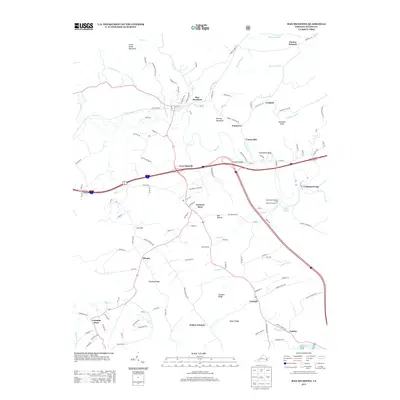
2013 Map of Max Meadows
USGS Topo · Published 2013About this map
Max Meadows and Fort Chiswell anchor this part of Wythe County, where the landscape is defined by the winding course of Reed Cr and the convergence of major travel corridors. The map records a mix of long-standing community centers and industrial legacies, such as Walton Furnace and the settlement of Grahams Forge. These names hint at the area's history of iron production and early manufacturing along the regional waterways.
Find a feature on this map
126 named features on this map. Tap any name to fly to it.
Don’t see what you’re looking for? This feature index may not catch every label — zoom into the map to look around manually.
Map Details
Editions of this 2013 Max Meadows Map
This is the sole edition of this map. No revisions or reprints were ever made.
Other maps of this area

1887 · Pocahontas
USGS Topo · 1:125,000

1889 · Hillsville
USGS Topo · 1:125,000

1889 · Wytheville
USGS Topo · 1:125,000

1890 · Dublin
USGS Topo · 1:125,000

1891 · Pocahontas
USGS Topo · 1:125,000

1891 · Dublin
USGS Topo · 1:125,000

1892 · Hillsville
USGS Topo · 1:125,000

1892 · Wytheville
USGS Topo · 1:125,000

1894 · Pocahontas
USGS Topo · 1:125,000

1895 · Pocahontas
USGS Topo · 1:125,000