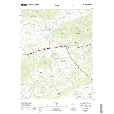
2019 Map of Max Meadows
USGS Topo · Published 2019About this map
Max Meadows and Fort Chiswell anchor this landscape where the modern intersection of Interstate 81 and Interstate 77 meets deep-rooted Wythe County history. The winding course of Reed Creek flows through the central valley, passing the James McGavock Cem and the Keesling Bridge. The area's industrial past is marked by Walton Furnace and the presence of Grahams Forge to the east, while the terrain rises sharply into Lick Mtn and Draper Mtn. Genealogists can trace family heritage through several burial sites, including the Jacob McGavock Cem and Sanders Cem, located near the small settlements of Laswell and Galena. The northern boundary reaches into the Jefferson National Forest, where Little Brush Mtn overlooks the Beaverdam Cr drainage.
Find a feature on this map
122 named features on this map. Tap any name to fly to it.
Don’t see what you’re looking for? This feature index may not catch every label — zoom into the map to look around manually.
Map Details
Editions of this 2019 Max Meadows Map
This is the sole edition of this map. No revisions or reprints were ever made.
Other maps of this area

1887 · Pocahontas
USGS Topo · 1:125,000

1889 · Hillsville
USGS Topo · 1:125,000

1889 · Wytheville
USGS Topo · 1:125,000

1890 · Dublin
USGS Topo · 1:125,000

1891 · Pocahontas
USGS Topo · 1:125,000

1891 · Dublin
USGS Topo · 1:125,000

1892 · Hillsville
USGS Topo · 1:125,000

1892 · Wytheville
USGS Topo · 1:125,000

1894 · Pocahontas
USGS Topo · 1:125,000

1895 · Pocahontas
USGS Topo · 1:125,000