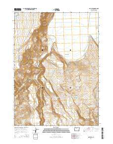
2014 Map of May Lake
USGS Topo · Published 2014About this map
Warner Valley dominates this high-desert landscape in Lake County, bordered by the steep ascent of the S Warner Rim. The topography is defined by a sophisticated network of water management features essential for ranching and land use in this arid region. Numerous numbered catchments, such as Cork Reservoir Number Seven, Hahilly Reservoir Number Four, and Six Pack Reservoir Number Four, indicate a highly managed water system designed to capture runoff from the rim. Near the southern edge, the elevation climbs towards Mosquito Mountain. This 2014 survey documents the persistence of remote rangeland infrastructure, with isolated water sources like Cattle Guard Spring and Spearpoint Spring serving as vital landmarks along primitive routes such as Twenty Mile Rd and Cahill Ln.
Find a feature on this map
29 named features on this map. Tap any name to fly to it.
Don’t see what you’re looking for? This feature index may not catch every label — zoom into the map to look around manually.
Map Details
Editions of this 2014 May Lake Map
This is the sole edition of this map. No revisions or reprints were ever made.
Other maps of this area

1886 · Alturas
USGS Topo · 1:250,000

1889 · Long Valley
USGS Topo · 1:250,000

1892 · Alturas
USGS Topo · 1:250,000

1954 · Vya
USGS Topo · 1:250,000

1954 · Alturas
USGS Topo · 1:250,000

1955 · Klamath Falls
USGS Topo · 1:250,000

1955 · Adel
USGS Topo · 1:250,000

1957 · Adel
USGS Topo · 1:250,000

1958 · Alturas
USGS Topo · 1:250,000

1958 · Klamath Falls
USGS Topo · 1:250,000