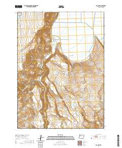
2020 Map of May Lake
USGS Topo · Published 2020About this map
South Warner Rim dominates the western topography of this high desert landscape, dropping sharply into the wide expanse of the Warner Valley. This portion of Lake County is defined by its water management systems, characterized by numbered catchments including Cork Reservoir Number Seven, Habillu Reservoir Number Four, and Expand Reservoir Number Thirty. These man-made features, alongside named natural points like May Lake and Lucky Reservoir, reflect the critical role of water storage in supporting local ranching and livestock operations. The presence of specific watering sites such as Cattle Guard Spring, Surveyor Spring, and Y Spring further highlights the utilitarian nature of the terrain. Connectivity across this sparsely populated region is maintained by a network of rural routes, including Twentymile Rd and Cahill Ln, which traverse the flats and skirt the base of prominent rises like Mosquito Mountain.
Find a feature on this map
23 named features on this map. Tap any name to fly to it.
Don’t see what you’re looking for? This feature index may not catch every label — zoom into the map to look around manually.
Map Details
Editions of this 2020 May Lake Map
This is the sole edition of this map. No revisions or reprints were ever made.
Other maps of this area

1886 · Alturas
USGS Topo · 1:250,000

1889 · Long Valley
USGS Topo · 1:250,000

1892 · Alturas
USGS Topo · 1:250,000

1954 · Vya
USGS Topo · 1:250,000

1954 · Alturas
USGS Topo · 1:250,000

1955 · Klamath Falls
USGS Topo · 1:250,000

1955 · Adel
USGS Topo · 1:250,000

1957 · Adel
USGS Topo · 1:250,000

1958 · Alturas
USGS Topo · 1:250,000

1958 · Klamath Falls
USGS Topo · 1:250,000