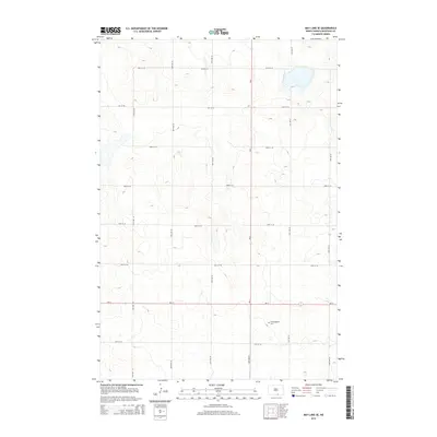
2014 Map of May Lake SE
USGS Topo · Published 2014About this map
Hoffnungsthal Cem serves as a singular cultural landmark in this largely agricultural landscape of McIntosh County. This 2014 survey captures a moment when the rural grid is defined by intersectional township roads such as 90th St SE and 37th Ave SE, reflecting the persistent section-line development of the Great Plains. The topography is characterized by subtle elevation changes and glacial depressions, many of which collect water in the eastern half of the quadrangle. Primary transit is facilitated by the junction of ND-3 and ND-11, which provide the backbone for regional movement between farmsteads and distant grain elevators. This map is particularly valuable for documenting the precise location of family burial sites and the established boundary roads like 42nd Ave SE that have structured this prairie landscape for generations.
Find a feature on this map
16 named features on this map. Tap any name to fly to it.
Don’t see what you’re looking for? This feature index may not catch every label — zoom into the map to look around manually.
Map Details
Editions of this 2014 May Lake SE Map
This is the sole edition of this map. No revisions or reprints were ever made.
Other maps of this area

1953 · Jamestown
USGS Topo · 1:250,000

1954 · Aberdeen
USGS Topo · 1:250,000

1956 · Aberdeen
USGS Topo · 1:250,000

1956 · Jamestown
USGS Topo · 1:250,000

1978 · Wolff Lake
USGS Topo · 1:24,000

1978 · Greenway
USGS Topo · 1:24,000

1978 · Venturia
USGS Topo · 1:24,000

1982 · Danzig
USGS Topo · 1:24,000

1982 · May Lake NW
USGS Topo · 1:24,000

1982 · May Lake SW
USGS Topo · 1:24,000