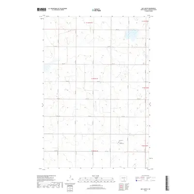
2018 Map of May Lake SE
USGS Topo · Published 2018About this map
Glacial depressions and prairie wetlands dominate this portion of the Missouri Coteau in McIntosh County. The landscape is defined by a rigorous grid of section lines, with secondary routes like 41st Ave SE and 97th St SE providing the only access through the rolling terrain. This rural expanse remains largely undeveloped, preserving a spatial pattern of isolated homesteads and community focal points typical of the northern Great Plains. In the southeastern corner, the proximity of Hoffnungsthal Cem and the Venturia Reformed Cem reflects the area's heritage of early religious congregations, where small country churches once served as the primary social and spiritual anchors for far-flung farming families.
Find a feature on this map
22 named features on this map. Tap any name to fly to it.
Don’t see what you’re looking for? This feature index may not catch every label — zoom into the map to look around manually.
Map Details
Editions of this 2018 May Lake SE Map
This is the sole edition of this map. No revisions or reprints were ever made.
Other maps of this area

1953 · Jamestown
USGS Topo · 1:250,000

1954 · Aberdeen
USGS Topo · 1:250,000

1956 · Aberdeen
USGS Topo · 1:250,000

1956 · Jamestown
USGS Topo · 1:250,000

1978 · Wolff Lake
USGS Topo · 1:24,000

1978 · Greenway
USGS Topo · 1:24,000

1978 · Venturia
USGS Topo · 1:24,000

1982 · Danzig
USGS Topo · 1:24,000

1982 · May Lake NW
USGS Topo · 1:24,000

1982 · May Lake SW
USGS Topo · 1:24,000