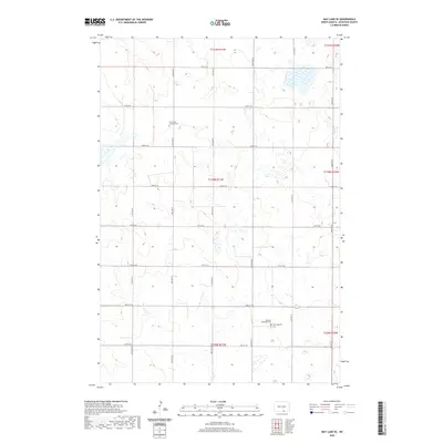
2020 Map of May Lake SE
USGS Topo · Published 2020About this map
McIntosh County's prairie landscape is defined by the rigid Public Land Survey System grid and the spiritual landmarks of its rural communities. In the northern reaches of this township, Saint Pauls Lutheran Cem stands as a solitary marker of local heritage along 38th Ave SE. The southeastern corner of the map reveals a clustering of religious sites including the Venturia Reformed Cem and Hoffnungsthal Cem, situated near the intersection of 96th St SE and 40th Ave SE. These cemeteries, preserved amid a network of section-line roads such as 90th St SE and 42nd Ave SE, provide essential touchstones for genealogists tracing the early settlement patterns of this North Dakota region.
Find a feature on this map
24 named features on this map. Tap any name to fly to it.
Don’t see what you’re looking for? This feature index may not catch every label — zoom into the map to look around manually.
Map Details
Editions of this 2020 May Lake SE Map
This is the sole edition of this map. No revisions or reprints were ever made.
Other maps of this area

1953 · Jamestown
USGS Topo · 1:250,000

1954 · Aberdeen
USGS Topo · 1:250,000

1956 · Aberdeen
USGS Topo · 1:250,000

1956 · Jamestown
USGS Topo · 1:250,000

1978 · Wolff Lake
USGS Topo · 1:24,000

1978 · Greenway
USGS Topo · 1:24,000

1978 · Venturia
USGS Topo · 1:24,000

1982 · Danzig
USGS Topo · 1:24,000

1982 · May Lake NW
USGS Topo · 1:24,000

1982 · May Lake SW
USGS Topo · 1:24,000