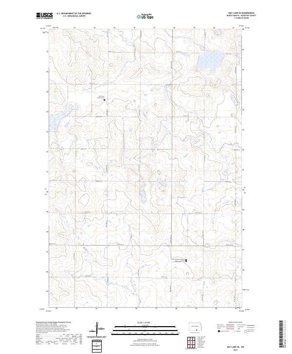
2024 Map of May Lake SE
USGS Topo · Published 2024About this map
Glacial prairie potholes and scattered wetlands define this section of the Great Plains in South Central North Dakota. The landscape is dominated by the Mcintosh County Waterfowl Production Area, a significant conservation tract in the northeastern corner of the sheet. This area illustrates the persistence of the prairie pothole ecosystem amidst the region's agricultural grid of gravel roads and section lines. The map reveals the rural spiritual and genealogical roots of the area through sites such as the Saint Pauls Lutheran Cem and the Venturia Reformed Cem Hoffnungsthal Cem. The surveyed townships, including t130n r71w, show a settlement pattern of dispersed farmsteads connected by a strictly regularized road network, including 38th Ave SE and 93rd St SE, typical of the late twentieth and early twenty-first-century agrarian Midwest.
Find a feature on this map
25 named features on this map. Tap any name to fly to it.
Don’t see what you’re looking for? This feature index may not catch every label — zoom into the map to look around manually.
Map Details
Editions of this 2024 May Lake SE Map
This is the sole edition of this map. No revisions or reprints were ever made.
Other maps of this area

1953 · Jamestown
USGS Topo · 1:250,000

1954 · Aberdeen
USGS Topo · 1:250,000

1956 · Aberdeen
USGS Topo · 1:250,000

1956 · Jamestown
USGS Topo · 1:250,000

1978 · Wolff Lake
USGS Topo · 1:24,000

1978 · Greenway
USGS Topo · 1:24,000

1978 · Venturia
USGS Topo · 1:24,000

1982 · Danzig
USGS Topo · 1:24,000

1982 · May Lake NW
USGS Topo · 1:24,000

1982 · May Lake SW
USGS Topo · 1:24,000