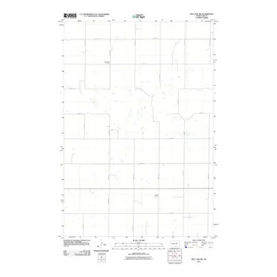
2011 Map of May Lake SW
USGS Topo · Published 2011About this map
The agricultural landscape of McIntosh County, North Dakota, is defined by a rigorous section-line grid of rural roads and scattered prairie potholes. The quietude of this landscape is punctuated by two specific sites of local genealogical significance: Kassel Cemetery and New Kassel Cemetery. These burial grounds reflect the heritage of the German-Russian settlers who established farms in this region of the Great Plains. The topography is predominantly open country, stitched together by routes such as 90th St SE and 32nd Ave SE, which facilitate the movement of equipment and grain across the rolling terrain. Small, unnamed wetlands and depressions are interspersed between the fields, typical of the glaciated plains of central North Dakota.
Find a feature on this map
15 named features on this map. Tap any name to fly to it.
Don’t see what you’re looking for? This feature index may not catch every label — zoom into the map to look around manually.
Map Details
Editions of this 2011 May Lake SW Map
This is the sole edition of this map. No revisions or reprints were ever made.
Other maps of this area

1953 · Jamestown
USGS Topo · 1:250,000

1954 · Aberdeen
USGS Topo · 1:250,000

1956 · Aberdeen
USGS Topo · 1:250,000

1956 · Jamestown
USGS Topo · 1:250,000

1978 · Greenway
USGS Topo · 1:24,000

1978 · Zeeland
USGS Topo · 1:24,000

1978 · Venturia
USGS Topo · 1:24,000
1980 · Hague SE
USGS Topo · 1:24,000

1982 · May Lake NW
USGS Topo · 1:24,000

1982 · May Lake SW
USGS Topo · 1:24,000