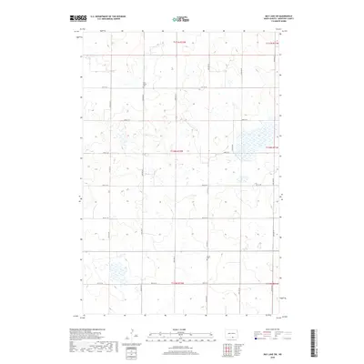
2018 Map of May Lake SW
USGS Topo · Published 2018About this map
McIntosh County’s agricultural landscape is defined by a grid of section lines and isolated cultural markers in this 2018 survey. The terrain is dotted with numerous small prairie wetlands and depressions, characteristic of the glaciated plains in North Dakota. Of significant interest for local genealogists and historians are the two burial grounds located in the western portion of the quadrangle: New Kassel Cem and Kassel Cem. These landmarks reflect the area's early German-Russian settlement patterns and provide specific points of reference for family history research. The township system, including t130n r72w and t131n r72w, organizes the territory into a precise network of farm-to-market roads such as 91st St SE and 32nd Ave SE.
Find a feature on this map
20 named features on this map. Tap any name to fly to it.
Don’t see what you’re looking for? This feature index may not catch every label — zoom into the map to look around manually.
Map Details
Editions of this 2018 May Lake SW Map
This is the sole edition of this map. No revisions or reprints were ever made.
Other maps of this area

1953 · Jamestown
USGS Topo · 1:250,000

1954 · Aberdeen
USGS Topo · 1:250,000

1956 · Aberdeen
USGS Topo · 1:250,000

1956 · Jamestown
USGS Topo · 1:250,000

1978 · Greenway
USGS Topo · 1:24,000

1978 · Zeeland
USGS Topo · 1:24,000

1978 · Venturia
USGS Topo · 1:24,000
1980 · Hague SE
USGS Topo · 1:24,000

1982 · May Lake NW
USGS Topo · 1:24,000

1982 · May Lake SW
USGS Topo · 1:24,000