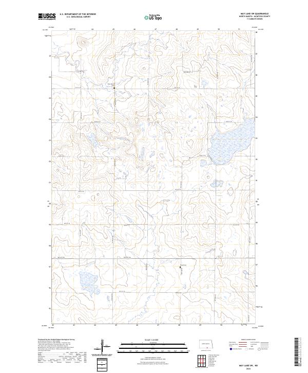
2024 Map of May Lake SW
USGS Topo · Published 2024About this map
The rolling grasslands of McIntosh County are defined by a rhythmic grid of rural section lines and isolated reminders of early settlement in this 2024 survey. The map centers on the townships of t130n r72w and t130n r71w, where the landscape is dotted with numerous small prairie potholes and wetlands. This area retains its agrarian character, with transportation dictated by gravel routes such as 91st St SE and 33rd Ave SE. Genealogical interest is anchored by two distinct burial sites: Kassel Cem and New Kassel Cem. These cemeteries, situated along the north-south corridors of 34th Ave SE and 32nd Ave SE, serve as quiet markers of the German-Russian heritage common to this part of North Dakota, preserving the names of the early farming families who organized these townships.
Find a feature on this map
21 named features on this map. Tap any name to fly to it.
Don’t see what you’re looking for? This feature index may not catch every label — zoom into the map to look around manually.
Map Details
Editions of this 2024 May Lake SW Map
This is the sole edition of this map. No revisions or reprints were ever made.
Other maps of this area

1953 · Jamestown
USGS Topo · 1:250,000

1954 · Aberdeen
USGS Topo · 1:250,000

1956 · Aberdeen
USGS Topo · 1:250,000

1956 · Jamestown
USGS Topo · 1:250,000

1978 · Greenway
USGS Topo · 1:24,000

1978 · Zeeland
USGS Topo · 1:24,000

1978 · Venturia
USGS Topo · 1:24,000
1980 · Hague SE
USGS Topo · 1:24,000

1982 · May Lake NW
USGS Topo · 1:24,000

1982 · May Lake SW
USGS Topo · 1:24,000