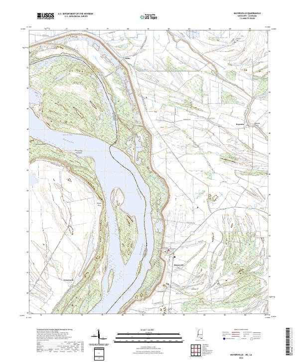
2024 Map of Mayersville
USGS Topo · Published 2024About this map
Mayersville serves as the focal point of this Mississippi Delta landscape, situated along the eastern bank of the Mississippi River at the boundary between Issaquena County and East Carroll Parish. As the county seat, the town is anchored by the Issaquena County Courthouse, with its street grid including Court St and Ripley St leading toward the levee. The surrounding terrain is a complex network of active and former river channels, characterized by features like Old River Chute, Opossum Chute, and Jack Falls Canal.
Find a feature on this map
57 named features on this map. Tap any name to fly to it.
Don’t see what you’re looking for? This feature index may not catch every label — zoom into the map to look around manually.
Map Details
Editions of this 2024 Mayersville Map
This is the sole edition of this map. No revisions or reprints were ever made.
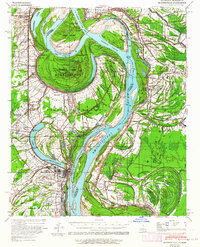
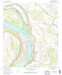
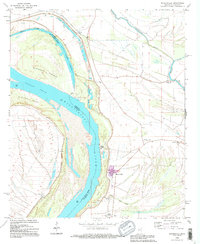
Historical Maps of Millers Landing Through Time
4 maps found