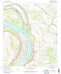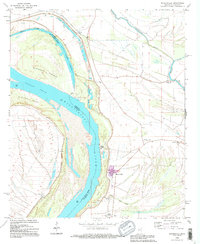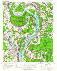
1939 Map of Mayersville
USGS Topo · Published 1964About this map
The Mississippi River and its shifting channel define this 1930s landscape along the border of Louisiana and Mississippi. The map meticulously documents hydrological changes, including the Sarah Cut-Off 1936 and the much earlier Bunchs Cut-Off 1830, which left behind significant oxbow features like Lake Providence. On the Louisiana side, the town of Lake Providence serves as a hub, while across the water in Mississippi, the settlement of Mayersville sits protected behind an extensive levee system.
Find a feature on this map
51 named features on this map. Tap any name to fly to it.
Don’t see what you’re looking for? This feature index may not catch every label — zoom into the map to look around manually.
Map Details
Editions of this 1939 Mayersville Map
This is the sole edition of this map. No revisions or reprints were ever made.
Historical Maps of Lake Providence Through Time
8 maps found