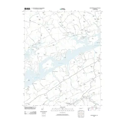
2010 Map of Maynardville
USGS Topo · Published 2010About this map
Maynardville serves as the focal point for this landscape in Union County, where the Tennessee ridge-and-valley system meets the waters of Big Ridge Lake. The map reveals a dense network of family-named landmarks and rural infrastructure, including the historic Berry-Peters Mill and the Sharps Chapel Post Office. The varied topography is defined by prominent features such as Hinds Ridge, Big Ridge, and Russell Ridge, which are separated by numerous hollows like Welch Hollow and Caneseed Hollow.
Find a feature on this map
136 named features on this map. Tap any name to fly to it.
Don’t see what you’re looking for? This feature index may not catch every label — zoom into the map to look around manually.
Map Details
Editions of this 2010 Maynardville Map
This is the sole edition of this map. No revisions or reprints were ever made.
Other maps of this area

1897 · Maynardville
USGS Topo · 1:125,000

1900 · Maynardville
USGS Topo · 1:125,000

1935 · Luttrell
USGS Topo · 1:24,000

1935 · Straw Plains
USGS Topo · 1:48,000

1935 · Graveston
USGS Topo · 1:24,000

1935 · Well Spring
USGS Topo · 1:24,000

1936 · Gorryton
USGS Topo · 1:48,000

1936 · Powder Springs
USGS Topo · 1:24,000

1936 · Ausmus
USGS Topo · 1:24,000
1936 · Clouds
USGS Topo · 1:24,000