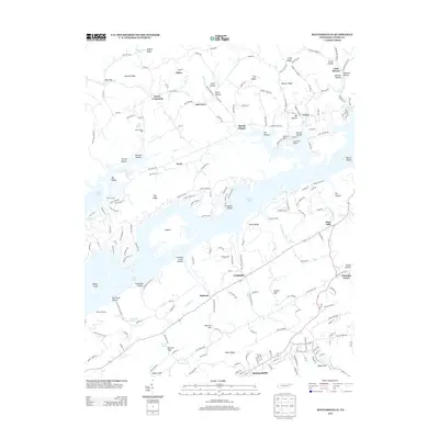
2013 Map of Maynardville
USGS Topo · Published 2013About this map
Maynardville serves as the focal point of this Union County landscape, where the ridge-and-valley topography of East Tennessee meets the intricate fingers of Norris Lake. The map reveals a transition from traditional upland settlements like Sharps Chapel and Oak Grove to the modern recreational and transport features of the reservoir area, including Lake View Airport and Lakeview Dock. This modern survey documents the complex shoreline formed by flooded valleys, creating prominent landforms like Island F and Beech Island.
Find a feature on this map
207 named features on this map. Tap any name to fly to it.
Don’t see what you’re looking for? This feature index may not catch every label — zoom into the map to look around manually.
Map Details
Editions of this 2013 Maynardville Map
This is the sole edition of this map. No revisions or reprints were ever made.
Other maps of this area

1897 · Maynardville
USGS Topo · 1:125,000

1900 · Maynardville
USGS Topo · 1:125,000

1935 · Luttrell
USGS Topo · 1:24,000

1935 · Straw Plains
USGS Topo · 1:48,000

1935 · Graveston
USGS Topo · 1:24,000

1935 · Well Spring
USGS Topo · 1:24,000

1936 · Gorryton
USGS Topo · 1:48,000

1936 · Powder Springs
USGS Topo · 1:24,000

1936 · Ausmus
USGS Topo · 1:24,000
1936 · Clouds
USGS Topo · 1:24,000