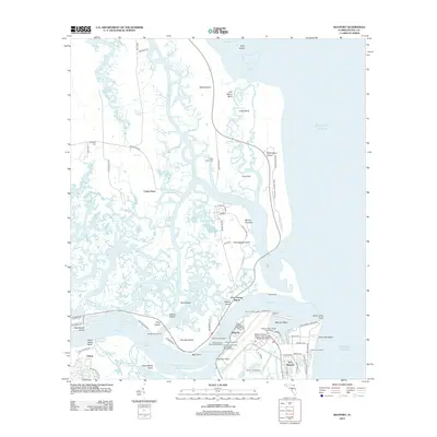
2012 Map of Mayport
USGS Topo · Published 2012About this map
The Saint Johns River meets the Atlantic Ocean at this strategic coastal corridor, a landscape defined by maritime industry and military operations. The prominent Mayport Naval Station and the USCG Base Mayport Wharf anchor the southern bank, while the Saint Johns Light stands near Seminole Beach. This area is a complex network of marshes and islands, including Talbot Island and Fort George Island, connected by the Intracoastal Waterway.
Find a feature on this map
99 named features on this map. Tap any name to fly to it.
Don’t see what you’re looking for? This feature index may not catch every label — zoom into the map to look around manually.
Map Details
Editions of this 2012 Mayport Map
This is the sole edition of this map. No revisions or reprints were ever made.
Other maps of this area

1918 · St Marys
USGS Topo · 1:62,500

1918 · Jacksonville
USGS Topo · 1:62,500

1918 · Mayport
USGS Topo · 1:62,500

1919 · Fernandina
USGS Topo · 1:62,500

1919 · St Marys
USGS Topo · 1:62,500

1944 · Fernandina
USGS Topo · 1:62,500

1948 · Jacksonville
USGS Topo · 1:250,000

1948 · Jacksonville Beach
USGS Topo · 1:24,000

1948 · Eastport
USGS Topo · 1:24,000

1949 · Jacksonville Beach
USGS Topo · 1:24,000
Featured Places
- Jacksonville, FL
- Fort George Island, Jacksonville
- Mayport, Jacksonville
- East Mayport, Jacksonville
- Duval County, FL