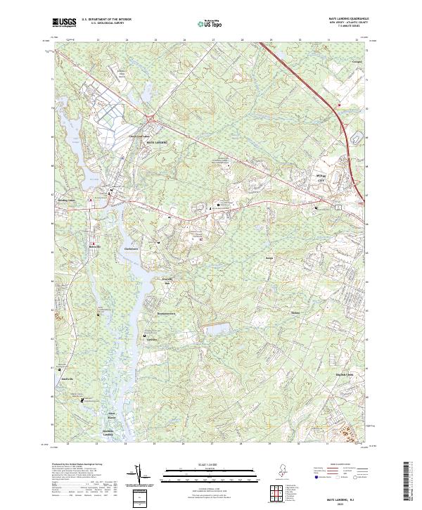
2023 Map of Mays Landing
USGS Topo · Published 2023About this map
The Great Egg Harbor River carves through the landscape of central Atlantic County, serving as the historical and geographic anchor for Mays Landing. This survey documents a complex network of burial grounds and early settlements, from the riverside Steelman Landing and Catawba to the northern enclave of Cologne. The convergence of the Black Horse Pike and the river defines the regional transit patterns, while the expansive Babcock Swamp and Jack Pudding Branch illustrate the preservation of the area's characteristic wetlands amidst suburban growth near McKee City.
Find a feature on this map
208 named features on this map. Tap any name to fly to it.
Don’t see what you’re looking for? This feature index may not catch every label — zoom into the map to look around manually.
Map Details
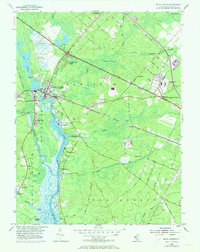
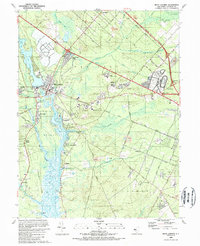
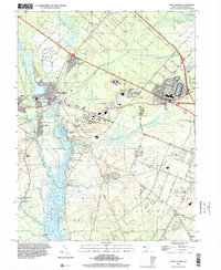
Editions of this 2023 Mays Landing Map
This is the sole edition of this map. No revisions or reprints were ever made.
Historical Maps of Estell Manor Through Time
4 maps found
Featured Locations
- Galloway Township, NJ
- Hamilton Township, NJ
- Weymouth Township, NJ
- Egg Harbor Township, NJ
- Estell Manor, NJ