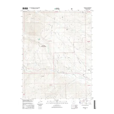
2016 Map of Maysville
USGS Topo · Published 2016About this map
Maysville sits along the southern edge of this mountain landscape, a focal point for the surrounding San Isabel National Forest. The topography is dominated by the high-altitude peaks of Mt Shavano and Tabeguache Peak, with the Mt Shavano Trail and Colorado Trail providing access to the steep terrain. This area demonstrates a sophisticated water management history, evidenced by the intricate system of gravity-fed irrigation channels including Cameron Ditch, Missouri Park Ditch, and N Fork Ditch that draw from the S Arkansas River. These diversions illustrate how the local economy adapted high-mountain runoff for downstream use. The drainage network is dense, featuring numerous named gulches like Droney Gulch and Cedar Gulch which feed into the main river forks and alpine water bodies such as Shavano Lake.
Find a feature on this map
58 named features on this map. Tap any name to fly to it.
Don’t see what you’re looking for? This feature index may not catch every label — zoom into the map to look around manually.
Map Details
Editions of this 2016 Maysville Map
This is the sole edition of this map. No revisions or reprints were ever made.
Other maps of this area

1940 · Garfield
USGS Topo · 1:62,500

1945 · Garfield
USGS Topo · 1:62,500

1956 · Poncha Springs
USGS Topo · 1:62,500

1956 · Montrose
USGS Topo · 1:250,000

1959 · Montrose
USGS Topo · 1:250,000

1959 · Bonanza
USGS Topo · 1:62,500

1960 · Montrose
USGS Topo · 1:250,000

1967 · Pahlone Peak
USGS Topo · 1:24,000

1968 · Montrose
USGS Topo · 1:250,000
1980 · Poncha Pass
USGS Topo · 1:24,000