1983 Map of Maysville
USGS Topo · Published 1983About this map
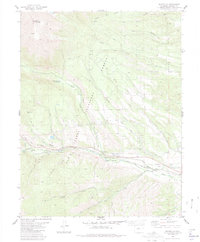
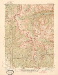
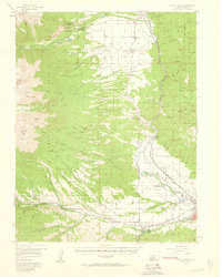
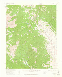
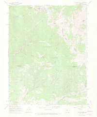
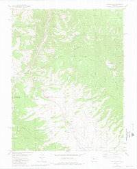
Mount Shavano anchors the high-altitude terrain of the San Isabel National Forest in this early 1980s landscape. The settlement of Maysville sits along the Arkansas River, serving as a focal point for the complex water management system of the era. A network of irrigation channels and water transport features, including the Weldon Ditch, Hoosier Ditch, and the Denver and Rio Grande Western Aqueduct, highlights the critical role of water rights in this mountainous region. Industrial activity is evidenced by scattered Mine and Prospects labels, while recreational development is shown via the Angel of Shavano Campground and the Picnic Area. The presence of the Denver and Rio Grande Western Arkansas River corridor illustrates the historical integration of rail infrastructure with the natural river valley.
Find a feature on this map
37 named features on this map. Tap any name to fly to it.
Don’t see what you’re looking for? This feature index may not catch every label — zoom into the map to look around manually.
Map Details
Editions of this 1983 Maysville Map
This is the sole edition of this map. No revisions or reprints were ever made.
Other maps of this area

1940 · Garfield
USGS Topo · 1:62,500
1945 · Garfield
USGS Topo · 1:62,500
1956 · Poncha Springs
USGS Topo · 1:62,500

1956 · Montrose
USGS Topo · 1:250,000

1959 · Montrose
USGS Topo · 1:250,000
1959 · Bonanza
USGS Topo · 1:62,500

1960 · Montrose
USGS Topo · 1:250,000
1967 · Pahlone Peak
USGS Topo · 1:24,000

1968 · Montrose
USGS Topo · 1:250,000
1980 · Poncha Pass
USGS Topo · 1:24,000