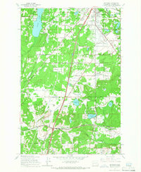
1959 Map of Maytown
USGS Topo · Published 1966About this map
Tumwater and the surrounding lowland prairies of south Thurston County are captured here just before the mid-century expansion of the Interstate system. The landscape is defined by the convergence of major rail lines, including the Union Pacific, Northern Pacific, and the Chicago Milwaukee St Paul and Pacific. These tracks weave through a mosaic of small farming settlements and timberlands, connecting established hubs like Belmore and Maytown.
Find a feature on this map
68 named features on this map. Tap any name to fly to it.
Don’t see what you’re looking for? This feature index may not catch every label — zoom into the map to look around manually.
Map Details
Editions of this 1959 Maytown Map
3 editions found
Other maps of this area

1916 · Chehalis
USGS Topo · 1:125,000

1937 · Olympia
USGS Topo · 1:62,500

1939 · Shelton
USGS Topo · 1:62,500

1940 · Tenino
USGS Topo · 1:62,500

1941 · Gate
USGS Topo · 1:62,500

1944 · Tenino
USGS Topo · 1:62,500

1949 · Tenino
USGS Topo · 1:62,500

1949 · Olympia
USGS Topo · 1:62,500

1953 · Hoquiam
USGS Topo · 1:250,000

1953 · Rochester
USGS Topo · 1:62,500