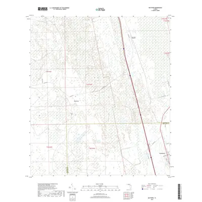
2018 Map of Maytown
USGS Topo · Published 2018About this map
Maytown and the surrounding marshlands of the Volusia and Brevard County line are captured in this 2018 survey. The landscape is defined by extensive wetlands, including the Spruce Creek Swamp in the north and numerous unnamed ponds and depressions throughout the central interior. To the east, the settlement of Scottsmoor appears along a grid of local streets such as Magoon Ave and Vermont St, adjacent to the north-south corridor of the Interstate.
Find a feature on this map
25 named features on this map. Tap any name to fly to it.
Don’t see what you’re looking for? This feature index may not catch every label — zoom into the map to look around manually.
Map Details
Editions of this 2018 Maytown Map
This is the sole edition of this map. No revisions or reprints were ever made.
Other maps of this area

1949 · Oak Hill
USGS Topo · 1:24,000

1949 · Mims
USGS Topo · 1:24,000

1949 · Osceola
USGS Topo · 1:24,000

1950 · Maytown
USGS Topo · 1:24,000

1950 · Ariel
USGS Topo · 1:24,000

1950 · Edgewater
USGS Topo · 1:24,000

1950 · Aurantia
USGS Topo · 1:24,000

1952 · Mims
USGS Topo · 1:24,000

1953 · Geneva
USGS Topo · 1:24,000

1955 · Orlando
USGS Topo · 1:250,000