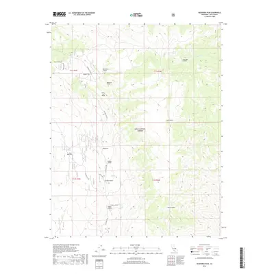
2018 Map of Mazourka Peak
USGS Topo · Published 2018About this map
Mazourka Peak rises as a prominent landmark in this high-elevation corner of the Inyo National Forest. The landscape is defined by the complex topography of the White Inyo Range, where seasonal drainage patterns have carved out dramatic features like Waucoba Canyon and Mazourka Canyon. For those studying the high-desert environment, the map identifies critical water sources such as Santa Rita Spring, Johnson Spring, and Barrel Springs. The presence of Badger Flat and the network of primitive routes, including the Santa Rita Flat Rd, reveal how travelers and foresters navigated this arid terrain. Names like Bonanza Gulch and Lead Canyon reflect the region's historical associations with prospecting and mineral extraction, common throughout this part of Inyo County.
Find a feature on this map
25 named features on this map. Tap any name to fly to it.
Don’t see what you’re looking for? This feature index may not catch every label — zoom into the map to look around manually.
Map Details
Editions of this 2018 Mazourka Peak Map
This is the sole edition of this map. No revisions or reprints were ever made.
Other maps of this area

1907 · Mt. Whitney
USGS Topo · 1:125,000

1908 · Lida
USGS Topo · 1:250,000

1908 · Ballarat
USGS Topo · 1:250,000

1913 · Bishop
USGS Topo · 1:125,000

1913 · Lida
USGS Topo · 1:250,000

1913 · Ballarat
USGS Topo · 1:250,000

1919 · Mt. Whitney
USGS Topo · 1:125,000

1937 · Mt. Whitney
USGS Topo · 1:125,000

1947 · Mariposa
USGS Topo · 1:250,000

1948 · Death Valley
USGS Topo · 1:250,000