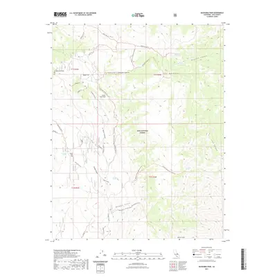
2021 Map of Mazourka Peak
USGS Topo · Published 2021About this map
Mazourka Peak dominates the high-altitude landscape of the White- Inyo Range in this modern survey of eastern California. The terrain within the Inyo National Forest is defined by a network of historic trails and remote water sources, indicating a legacy of high-country exploration and mining activity. Routes like the Bluebell Mine Trl and Tamarack Canyon Trl traverse steep relief between prominent landforms such as Badger Flat and Santa Rita Flat. Life in this arid environment centers on vital points like Santa Rita Spring, Barrel Springs, and Side Hill Spring. The map documents a complex drainage system including Waucoba Wash and deep incisions like Pops Gulch and Mazourka Canyon, reflecting the geological character of the Inyo Mountains.
Find a feature on this map
41 named features on this map. Tap any name to fly to it.
Don’t see what you’re looking for? This feature index may not catch every label — zoom into the map to look around manually.
Map Details
Editions of this 2021 Mazourka Peak Map
This is the sole edition of this map. No revisions or reprints were ever made.
Other maps of this area

1907 · Mt. Whitney
USGS Topo · 1:125,000

1908 · Lida
USGS Topo · 1:250,000

1908 · Ballarat
USGS Topo · 1:250,000

1913 · Bishop
USGS Topo · 1:125,000

1913 · Lida
USGS Topo · 1:250,000

1913 · Ballarat
USGS Topo · 1:250,000

1919 · Mt. Whitney
USGS Topo · 1:125,000

1937 · Mt. Whitney
USGS Topo · 1:125,000

1947 · Mariposa
USGS Topo · 1:250,000

1948 · Death Valley
USGS Topo · 1:250,000