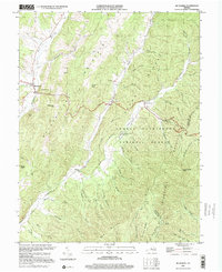
1999 Map of Mc Dowell
USGS Topo · Published 2001About this map
McDowell sits at the junction of mountain roads and the Bullpasture River, serving as a focal point for this Highland County landscape. The terrain is defined by parallel ridges including Bullpasture Mountain and Shaws Ridge, creating a series of deep valleys known locally as drafts and hollows. These secluded corridors, such as Hiner Hollow and Jerry Hollow, historically hosted small farmsteads and family settlements.
Find a feature on this map
57 named features on this map. Tap any name to fly to it.
Don’t see what you’re looking for? This feature index may not catch every label — zoom into the map to look around manually.
Map Details
Editions of this 1999 Mc Dowell Map
This is the sole edition of this map. No revisions or reprints were ever made.
Other maps of this area

1894 · Staunton
USGS Topo · 1:125,000

1901 · Monterey
USGS Topo · 1:125,000

1924 · Mc Dowell
USGS Topo · 1:62,500

1941 · Monterey
USGS Topo · 1:62,500

1943 · Craigsville
USGS Topo · 1:62,500

1944 · Monterey
USGS Topo · 1:62,500

1944 · Mc Dowell
USGS Topo · 1:62,500

1945 · Craigsville
USGS Topo · 1:62,500

1946 · Mc Dowell
USGS Topo · 1:62,500

1946 · Williamsville
USGS Topo · 1:62,500